
165-mph Cat-5 Hurricane Melissa Targets Jamaica’s 3.0M People; Airports Closed, Rain Up to 40 Inches Forecast
11/11/20251 min read

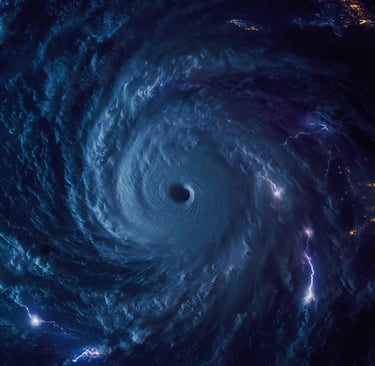
A rare Category 5 landfall threat is bearing down on an island of ~3.0 million people, with forecast rain 15–30 inches and local peaks to 40 inches (≈1,016 mm) plus storm surge 9–13 ft on the south coast. Both international airports are closed; authorities have activated ~900 shelters. Losses are expected in the billions if core impacts persist.
The NHC’s EDT advisory lists max winds 165 mph (270 km/h), minimum central pressure 908 mb, and a crawl at 3 mph (6 km/h) about 230 km SW of Kingston. Rainfall guidance: 15–30 inches Jamaica/southern Hispaniola, up to 40 inches in eastern Jamaica; eastern Cuba 10–15 inches, local 20. Norman Manley (KIN) and Sangster (MBJ) are shut as evacuation orders expand around Kingston/Port Royal. Officials and wires describe Melissa as the strongest hurricane to threaten Jamaica since record-keeping began in 1851. Season to date: 13 named storms.
Rapid intensification over anomalously warm waters pushed Melissa to Cat-5; parts of the Atlantic are ~2–3 °C above normal, a setup linked to more frequent <24-hour jumps to major intensity and extreme rainfall risk.
This is a hydrology-plus-logistics event: 40-inch rain potential, 9–13 ft surge, airport closures and widespread sheltering compress humanitarian and economic exposure into the next 24–48 hours. Watch for first insured-loss estimates, any Jamaica-linked cat-bond triggers, and power/water restoration timelines as the storm approaches and crosses the island.
Earthian AI
Earthian AI is the Earth-focused risk intelligence engine headquartered in the Netherlands with international offices in Munich, Germany, and Paris, France.
hello@earthianai.com
© 2025. All rights reserved.
Netherlands
Munich: Josephspitalstraße 15, Bavaria 80331, DE
Enschede: De Hems 10, 7522NL, NL (Mailing)
Tel: +31 641 19 16 81
Germany
Amsterdam: Rokin 92, 1012KZ, NL
Tel: +49 160 978 38 013
France
Station F
Paris: 5 parvis Alan Turing, 75013 Paris, France